Location and Landscape
Tel Ḥadid is a prominent, multi-layered archaeological site situated on an isolated hill rising to 147 m above sea level, just south of Naḥal Natuf, a tributary of Naḥal Ayalon. Located approximately 15 km southeast of Tel Aviv and 25 km northwest of Jerusalem, the site occupies a pivotal position at the interface between the central coastal plain and the western margins of the highlands. It consists of two components: a lower hill covering roughly 40 hectares, and a mound atop it of about 4 hectares at its summit. Together, these features enable Tel Ḥadid to command a landscape defined by movement, visibility, and connectivity.


From the top of the tell, the Lydda Valley stretches westward, forming a broad and fertile corridor that has served as a major axis of transportation and communication since antiquity, through which passed the principal north–south route of the Levant—commonly identified with the Via Maris, linking Egypt with Syria and beyond. To the east, the terrain rises toward the highlands, where routes ascending from the plain lead toward Jerusalem and the central hill country. Tel Ḥadid stands precisely at the junction of these systems, overlooking both the longitudinal routes of the coastal plain and the transversal routes connecting the port of Jaffa with the inland highlands. Its elevated position afforded both visual command and strategic control, shaping its role across successive historical periods.
The physical character of the site is defined not only by its topography but also by its geology and land use. The hill is composed primarily of chalk overlain by a hardened nari crust. The weathering of the chalk has produced numerous natural cavities, caves, and accumulations of collapsed debris, visible across the slopes and summit.
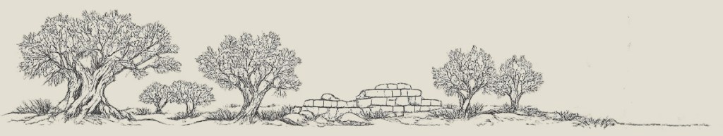
Today, Tel Ḥadid is largely covered by olive orchards, which dominate its appearance and structure movement across the site. These groves, many of them cultivated by the inhabitants of the former village of al-Ḥaditha, form an integral part of the landscape rather than a superficial layer. The spacing of the trees, the terracing, and the associated agricultural installations shape both visibility and access, while also preserving traces of earlier activity beneath and between them.

Written Sources and Historical Memory

Tel Ḥadid is not only a commanding feature in the landscape; it is also embedded in a long, though uneven, tradition of written sources spanning from the Persian period (6th–4th centuries BCE) through late antiquity and into the medieval and modern eras. These sources, while intermittent, consistently point to the site’s significance within the historical geography of the southern Levant.
The earliest references appear in the Hebrew Bible. Ḥadid is mentioned among the settlements of those returning from the Babylonian exile in the Book of Ezra (Ezra 2:33) and the Book of Nehemiah (Nehemiah 7:37; 11:34), situating it within the administrative and settlement framework of the Persian-period province of Yehud. These references suggest that Ḥadid formed part of a network of communities re-established or reorganized in the wake of imperial intervention and population movements.
The site reappears in the Late Hellenistic period (2nd–1st centuries BCE) in the First Book of Maccabees (12:38; 13:13), where Ḥadid (now called Adida) is described as being fortified by Simon Maccabeus during his war against Diodotus Tryphon, who usurped the Seleucid throne. The narrative situates the confrontation in the valley below the site, highlighting its role as a strategic stronghold overlooking key routes. Ḥadid is again mentioned in the late 1st century CE by Josephus (Jewish War 4.9.1), who recounts how the Roman general—and later emperor—Vespasian fortified the site as part of his campaign to control access to Jerusalem during the First Jewish Revolt. The decision to fortify Ḥadid underscores its continued strategic importance within the network of routes linking the coastal plain to the highlands. Rabbinic literature preserves this layer of memory: the Mishnah (Arakhin 9:6) includes Ḥadid among the towns fortified “from the days of Joshua,” embedding the site within a longue durée tradition that connects historical reality (the Hellenistic- and Roman-period fortifications) with collective memory.
Late antique scholarship reflects both the persistence of this memory and the challenges of locating it within the landscape. Eusebius of Caesarea, writing in the 4th century CE, identified Ḥadid (Aditha) with the biblical town of Adithaim (Joshua 15:36), placing it within the territory of Judah. This identification, however, appears to have been based primarily on phonetic similarity rather than geographical accuracy, as Adithaim is generally located in the Judean Shephelah, further south of the Lydda Valley. A similar tradition is reflected in the Madaba Map, where a village west of Jerusalem is labelled Adiathim, now read as Aditha.
The site re-emerges in the 13th century in the writings of the Jewish scholar and traveler Ishtori Haparchi, who described a village named Ḥaditha situated atop a rounded hill east of Lydda and identified it with biblical Ḥadid. His account, grounded in direct familiarity with the landscape, marks a renewed and more geographically accurate engagement with the site and has been widely accepted in modern scholarship.
Subsequent centuries again offer only fragmentary evidence. The history of the village of al-Ḥaditha remains only partially documented, reflecting broader gaps in the written record of rural settlements in the region. More continuous documentation emerges in the nineteenth century, when the landscapes of Ottoman Palestine were increasingly recorded by travelers, surveyors, and administrative authorities. These sources describe the village of al-Ḥaditha as situated atop the tell and integrated within its agricultural surroundings.
Why excavate at Tel Hadid?
At first glance, Tel Ḥadid may appear as a quiet hill covered with olive trees. Yet beneath these orchards lies a site with a long and complex history—one that has only begun to be explored.

Site Map
Explore the excavation areas with the interactive map.